Trip Recap

September 19, 2007

OK, this is going to be a short e-mail, promise.

The best thing about this trip: to have connected and reconnected with friends who I hadn’t seen in years. It was wonderful to have gotten to know you better.

I will not forget the generosity of my friends, starting with David who loaned me his brand new pick-up truck to drive cross country. It would have been a very different trip in a sedan. No camping and no creepy dirt roads.

From east to west: thank you Jeff for letting me stay with you in P-town. It was a good way to ease into this trip.

Thank you James for your input and for helping me to figure out how long it would take to get to all the places. You put me at ease, at least for a little while. On my next visit I will take advantage of your hammock!

Diane and Richard, thank you for your trip suggestions. I have to go back to Sisters when the sun shines and Crater Lake is on the list for the next trip. Thank you for your hospitality, loved the pancakes! Richard, have you finished the countertop?

Carol it was great to finally meet your son. Catching up with you of course was wonderful as well. Can’t believe it had been five years. Thank you for showing me around town.

Lynn and Doug, thank you so much for opening both your San Francisco home and your place in Lake Tahoe to me. It was great to get to know your family a little.

Thank you Priscilla for taking time to show me San Fran and for your Louisville suggestions. It is a nice town. It was very nice to meet your daughter as well. Keep on working on the playhouse.

Thank you Leslie for giving me a place to stay out in almost nowhere (Lawrence, Kansas).

Phil and Michelle, staying with you was great. I had fun with your kids in the pool. Staying with you made it a little easier coming back to the big city.

Thank you Bobby for loaning me your GPS, it was reassuring to have.

Thank you to all of you who supported me via e-mail and phone. Your e-mails felt like a lifeline.

Thank you Mary for your input. You were always right on the money. I am breathing again!

If any of you come to New York, please give me a call, I mean it!

Most memorable moment: a dozen roses in my bedroom in Lake Tahoe, thank you Lynn!

The place I am most likely to go back to, other than visiting my friends: the area around Moab, Utah. Definitely deserves more than just three hours of my time.

Place I am least likely to go back to: Niagara Falls

Would I do this again: definitely. Little more time or smaller territory

Days on the road: 52

Total miles driven: 11,700

Days without any driving: 8

Fewest miles driven in a day: 93 Burlington, VT to Tupper Lake, NY

Most miles driven in a day: 520 Sisters, OR to Bellingham, WA – didn’t really want to

Number of states traveled thru, not counting Connecticut, Rhode Island, Delaware &

New Jersey: 27

Number of pictures taken: approximately 3,800. I am working on them now.

Worst roads: Manhattan, hands down! Even the dirt roads out west were better.

Nights stayed in motels: 14

Nights stayed with friends: 17

Nights camped: 20

Gallons of gas purchased: 544

Average price per gallon: $2.92

Cheapest gas bought in: Pennsville, NJ, just across the Delaware border $2.46

Most expensive gas bought in: Brantford, Canada $3.40

Cost of this trip: PRICELESS!!!!

Keep in touch!

P.S. OK, not as short as I thought, sorry. Thank you for reading all my e-mails!

I hope you enjoyed my little trip down memory lane. I can’t believe it has been eight years since I took this trip. Some of it feels like it was only yesterday…

Golden Gate Bridge shrouded in fog

Golden Gate Bridge shrouded in fog

Heceta Head Lighthouse

Heceta Head Lighthouse – Oregon

Arches National Park

Arches National Park

Craters of the Moon National Monument and Preserve, branch in lava bed

Craters of the Moon – Idaho

Bull riding

Bull riding

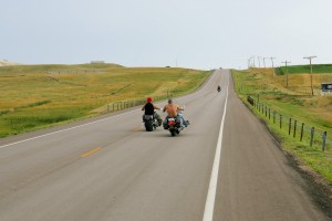
Bikers on highway 79 south

Bikers on highway 79 south – South Dakota

Snake River Canyon

Snake River Canyon – Idaho

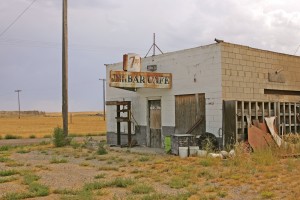
Abandoned bar along Main Street

Abandoned bar along Main Street- Idaho

Bellingham to SFO

September 15, 2007

Time travel back to August 23rd. I am writing this report from the comfort of my NYC apartment. I spent the afternoon looking at some of my photos from Washington, Oregon and California to refresh my memory. It was nice to reminisce a little. This trip will stay with me for a very long time. I have the feeling that I will remember little details out of the blue in the middle of the day which will put me right back on the highway.

Auto and train tunnel along the Columbia River

Auto and train tunnel along the Columbia River

Let’s get back to the trip from Bellingham to San Francisco. The weather was not the friendliest during my time in Bellingham and on my departure day. I chose to take highway 9/203/162 south instead of the horrible I-5 towards Mt. Rainier. This should be much less stressful and only a bit slower. The roads took me once again thru tiny towns along green fields with mountains not far. The roads were narrow and traffic was close to none existing. At least until I reached the outskirts of larger towns. I had to climb a couple of mountains which also meant a fast trip downhill. I did see the cop car on the bottom of the hill, waiting for all those speeders, but not in time to get to the proper speed. I believe I must have been going 75 mph in a 65 zone, luckily I did not get pulled over and there has been no ticket in the mail. It seems almost impossible to stick to the speed limit at those steep declines.

Historic train station

Historic train station

Around Eatonville, don’t ask how I remember, it was very woodsy and a creek was running along the left side of the road, really pretty. The weather had been quite good so far, little overcast but not gray. That, however changed when I got closer to Mt. Rainier. The mountain was none existing,

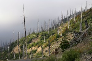
Dead trees on hillside along Forest Service Road 99 surrounding Mount St. Helens.  The trees died during the 1980 eruption of Mount St. Helens.

Dead trees on hillside along Forest Service Road 99 surrounding Mount St. Helens. The trees died during the 1980 eruption of Mount St. Helens.

completely hidden behind a thick cloud cover. I didn’t even bother to drive all the way to the base. I was disappointed that I didn’t get to see Mt. Rainier. Would I have been better of to drive thru the Olympic National Park over at the Pacific coast instead of traveling inland? I guess I will never find out. I decided to continue south to Mt. Saint Helens, hoping that the cloud cover would break. A woman at the visitor center near Mt. Rainier told me that it would be possible to get Cascade Locks, my destination for the day, on the Columbia River before dark. However, I should add at least an hour, each way, if I wanted to go to the viewing area along the eastern side of Mt. Saint Helens.

The drive on highway 25 towards the mountain was winding its way thru the forest, a very slow process. There was a dash of sunlight coming thru the clouds and I turned right at the turn-off to the viewing area, a full hour away. It was a race against the disappearing sun. I was so close I at least wanted to get a glimpse of the mountain. What I first saw were all the dead trees on the side of the mountains surrounding Mt. Saint Helens. They had been “killed” when St. Helens exploded back in the 1980s. It reminded me of all the dead trees in Yellowstone. Well, by the time I reached the viewing area the clouds had increased and I couldn’t see much of anything. At least I tried. Now the race with darkness began. The last thing I wanted to do was driving in the pitch black dark through the forest. I did not have many choices, there were no motels anywhere, and the closest campground put me quite a bit out of my way. Since I am somewhat stubborn, I headed towards Cascade Locks on the Oregon side of the Columbia River. Darkness once again came faster than expected.

Driving down a lonely forest road in the dark with tall trees to the left and right is not my idea of fun. There are no towns, not even tiny once, along the way for about 60 miles. The knowledge of the campground at the end of the road kept me going, a healthy dose of adrenalin helped as well. There were no lights, no houses and the small campground in the woods was dark as well. Not particularly inviting, and did I mention that I am stubborn? The only thing giving me a little light was the moon shining above. The dark creature on the side of the road turned out to be a big deer;

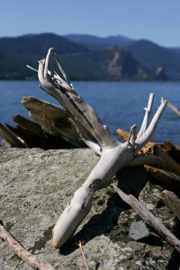
Driftwood along the Columbia River.

Driftwood along the Columbia River.

luckily he was walking away from the road. It took me two hours to drive the 60 miles. At that point I was too tired to set up camp and I opted for a motel. Not that easy either to find a place in the dark. I have a nose for wired places.   I am just glad that I didn’t see the big pile of old mattresses and furniture next to the motel

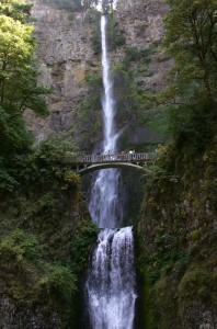
Multnomah Falls and Benson Bridge along the Historic Columbia River Highway

Multnomah Falls and Benson Bridge along the Historic Columbia River Highway

when I checked in. The bathroom was pretty unique, no shower walls only a curtain which separated the shower from the toilet, one continues floor. The mattress was about 30” of the ground; a step-stool would have been helpful. At least the room was quiet and didn’t smell.

The next day I explored the Columbia Gorge. A beautiful stretch of the Columbia River between Portland and Mt. Hood. Reminded my of the Hudson valley, except the mountains were a little higher. There are seven waterfalls along the route. All very skinny and after having seen two or three of them I did not stop anymore. Remember, I saw the big waterfall in Twin Falls. Off I went towards the Pacific Ocean, Cannon Beach. I was looking forward to driving down the coast and spending a little time at the beach. Not necessarily swimming, but just sitting at the beach enjoying the ocean. Cannon Beach is very nice, small, not too touristy, little artist community. Made it to the beach just before sunset. It was very windy and foggy. Looked neat, the fog was moving around the big boulders in the water.

Girls playing in the Pacific Ocean

Girls playing in the Pacific Ocean

Got up really early the next morning and headed for the beach (I camped). Damn, totally cloudy, not nice fog, just gray clouds. Took me forever to find a place that was open for breakfast, it was before 8 AM!

The drive down the coast was not as great as I had hoped. The weather was the biggest problem, gray, very windy and cold. No way that I would be able to hang out at the beach, not even in a warm sweater. Traffic was bad as well. Too many really slow drivers on a two lane highway can be extremely aggravating. I stopped in Tillamook, a big cheese town. I visited the cheese factory. I have a whole new respect for packaged cheese bricks. There is a lot of repetitive handwork involved until those little cheese bricks end up in the plastic bag. I talked to one worker and she told me that everyone has at least one of their wrist tendons fixed.

Oregon coast looking north

Oregon coast looking north

By mid-day the skies had cleared. There were a handful of overviews along highway 101 with amazing views up and down the Pacific Coast. Long stretches of the highway were a little inland with no view of the ocean. Towards evening fog started to move in from the ocean. Within seconds the road was swallowed up by fog and it cleared almost as quickly.

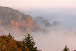
Samuel H. Boardman State Park - Fog covers the Oregon coast at sunset.

Samuel H. Boardman State Park – Fog covers the Oregon coast at sunset.

I camped in the redwoods in Crescent City just south of the Oregon border in California. Thanks to my warm sleeping bag I didn’t notice that the temperature had dropped. The campground lay in fog and it was only 54F / 12C. Not really that cold, but with the moisture in the air it was finger biting cold. After a hardy breakfast I felt much better and headed to the Redwood National Park. You don’t realize how big those trees are until you see a skinny, little pine tree next to them.

Continuing on hwy 101 the highway turned away from the coast further inland, no more water only trees which obstructed the view to the left and right. The highway eventually split into 101 and 1. I stayed on 101, a faster route, I know this was not a race, but I really wanted to get to SFO, people to meet, things to do. The inland temperatures were much higher and the sky was blue. I past thru Sonoma wine country. The trees gave way to vineyards. A quick stop

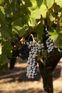
Wine grapes in Sonoma County

Wine grapes in Sonoma County

in Santa Rosa. I was looking for some local honey. Unfortunately, it was 6 PM on a Saturday and the stores were closed, how dare they. Cute place, especially the old downtown.

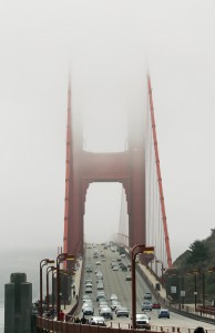
I could not have asked for a better welcome arriving in San Francisco. Late afternoon sunlight giving the city a reddish glow, blue sky, light on the Golden Gate Bridge. All toped of by the moon above the city, wow. As it always goes no place to pull over. I got a crappy shot through the open window in stop and go traffic.

After 1 ½ days in SFO off I went to Lake Tahoe, what a beautiful place. Kayaking on the lake, resting, spending time with friends. What a great way of life.

This is the last trip report. Thank you very much for reading. I will send one more short e-mail with a trip recap, stay tuned. Would I do this again, definitely!

See ya.

The End of The Journey Kansas To NYC

September 13, 2007

The end of the journey. The states are getting smaller and I find myself scrambling for maps much more frequently. I know, I could just follow the signs for highway 50 east, but I like to have the full picture in front of me.

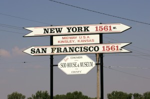
Midway USA marker, equal distance to San Francisco and New York.

Midway USA marker, equal distance to San Francisco and New York.

So I left Lawrence, Kansas and headed through Missouri to St. Louis. Kansas is very flat until you are east of Emporia and all of a sudden there are trees again and even rolling hills, big surprise. Highway 50 in western Missouri felt a little like a roller coaster, without the upside-down loop. Constant dipping down little hills and up again. Not that flat driving you experience on the interstate. The trees had moved closer to the road and it was all green again. I hadn’t seen anything forest like since Washington State. Yes, there are trees in Oregon and the redwood trees in northern California and of course there are also trees in Colorado, but those are not the dense forests you find in the east. At least not where I drove. I know I still owe you the report for the stretch from Bellingham to San Francisco. Hopefully, I have time over the weekend to write.

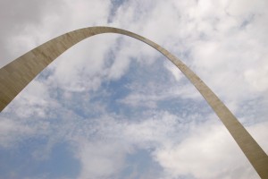
OK, back to Missouri. It was really wonderful I could look over the tree tops of the forests as far as my eyes could see, all green. Since I had a pretty late start in the morning, I only made it to St. Louis that day. The weather was gray and on the rainy side. I took very few pictures on the last stretch from Kansas to NYC. The weather was not great and the light was hazy and just not good enough for photos.   I only wanted to see the Gateway Arch in St. Louis and of course the weather was so gray that I could barely distinguish between the silver metal of the arch and the gray of the sky. I just made it back to the car in time before the skies opened up and it started to pour.

Gateway Arch

Gateway Arch

The last leg of this trip is a little blurry. I drove through seven states in just three days and I have a hard time remembering the differences between the states.

St. Louis to Louisville, Kentucky. More fields in Illinois, I think they might have been soybean fields. Once I got into Indiana the leaves on the trees started to change, yellow and red. Not sure if those were already fall colors or if the trees were distressed from the lack of rain. Instead of continuing straight east I dipped southeast to Louisville. Spent the night at a KOA just outside of town. It was weird to camp so close to a large city. It was my last night of camping. I really enjoyed camping. I never had to worry if the mattress was too soft or if the room might smell, as it was the case in several motels. A friend of mine had given me some tips where to go in Louisville and I spent some time the next morning exploring. Actually, I spent more time than I thought I would. I was torn between wanting to get home as soon as possible and at the same time I didn’t want the trip to end. I had looked at the map in the morning and figured that I could make it to Washington D.C. or at least very close

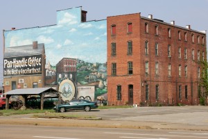
Chancellor-Burwell-Lowe House - Parkersburg, West Virginia

Chancellor-Burwell-Lowe House – Parkersburg, West Virginia

to it by nightfall. Oh, I was so wrong, but I wouldn’t find out until much later in the day. From Louisville I drove to Lexington. Another friend had told me about a beautiful stretch of highway between Lexington and Paris. Yes, there is a Paris in Kentucky too and another one in Virginia. That stretch of highway was really beautiful, wide rolling meadows, unfortunately not very green, divided by black horse fences. Not too many horses out on the meadows, it was pretty hot. Eventually, I ended up again on hwy 50 in Ohio and that’s when it hit me that I was still way over 300 miles west of D.C. There is not much of anything between Hillsboro, OH and Washington D.C. Lots of little towns/villages without any motels and no campgrounds. I hate when I don’t know where I’ll spend the night. Athens, OH seemed to be my best bet. Ever heard of Athens? Home of the Ohio University. After calling several places, I checked in at a Super 8 motel. Must have been very new, everything was clean and no funny carpet smell.

Old warehouse - Parkersburg, West Virginia

Old warehouse – Parkersburg, West Virginia

The drive from Athens to D.C. went mainly through West Virginia. A lot of mountain driving. Narrow roads with tons of tight curves and a lot of uphill driving. It was very pretty and the woods smelled like fall. I didn’t do this much mountain driving in Colorado. I passed thru several interesting little towns with nice old brick buildings.

By late afternoon I made it to D.C. Oh what fun driving on 495. Hadn’t seen that many cars since I-5 in Washington State. I spent two nights at my friends’ place in D.C. before heading home to NYC. Just a little more procrastinating. Unfortunately, I didn’t get to see all my friends in D.C.

The drive into Manhattan was pretty emotional. Seeing the skyline from New Jersey just made me crumble. The trip was over and I was home again. It felt like a load was taking of my shoulders. I finally could get the much needed rest. But before I could get that much needed rest I would have to deal with the NYC parking issues. I got into town at rush hour and traffic on First Avenue was hell. I did get a spot around the corner of my apartment and started unloading. I was lucky to get another spot in front of my building to get the big bags unloaded. All in all it took 2 ½ hours to unload. That included driving around the block several times and waiting to be legally parked. I was so tired that I didn’t read all the parking regulations. I only knew that I had to feed the meter at 9 AM. Well, I didn’t read the part that read no parking from 8:30 AM – 9 AM. So the trip ended the same way it started, with a parking ticket. I really didn’t care at that point anymore.

I have been home since Monday evening and I still haven’t gotten enough sleep. I am looking forward to the weekend. This is the first time in weeks that I have been thinking in terms of weekdays and weekend.

As mentioned earlier, I will send one more road report and a recap of the entire trip.

That’s it for now. Have to go to work!!

We are in Kansas Dorothy!

September 3, 2007

We are in Kansas Dorothy! And boy is it flat.

OK, here are the subject lines if I had written an e-mail every day.

Friday: I am so stupid, stupid, stupid

Saturday: This is absolutely mind blowing

Sunday: I just want to get home

Monday: This is a small world/what does it mean

Let me explain. On Friday I continued to drive on the loneliest highway in the US, hwy 50, to Utah.

Highway 50 looking east towards the Snake Range, Humboldt-Toiyabe National Forest

Highway 50 looking east towards the Snake Range, Humboldt-Toiyabe National Forest

East of Ely the mountain ranges changed. They used to run mostly parallel to the highway, but now they ran perpendicular to the highway. Once I drove thru one, a valley opened up and the next range was just a few miles away. Amazing, you just can’t get bored with stuff like that.

Once again I was hunting down a ghost town. What a disappointment. Luckily, it was not as creepy as the last one. I would not call this place a town. All that was left were some mining shafts and the usual rotten car. All that after driving up a mountain for a few miles on a dirt road at 10-15 mph.

Ghost Town - old mining hoist

Ghost Town – old mining hoist

I did make it into Utah. I can’t remember exactly how the mountains changed, but they did. Might have been the color or the shape, it seems so long ago. I think the mountains moved further away. There is really not much going on along this highway, towns are tiny and it comes as a surprise when they are bigger, like Delta. All of a sudden there were trees alongside the road, hadn’t seen those in a couple of days. The trees changed into a little green oasis and morphed into cultivated fields.

Fishlake National Forest north of Holden.

Fishlake National Forest north of Holden.

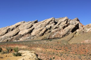
At the beginning of the day I had thought I make it to the KOA in Green River, near Moab and Arches National Park.  Later in the day I had settled for Richfield, about 100 miles west of Green River. Highway 50 merges with interstate 70 soon after Delta all the way to Grand Junction, Colorado. I asked a lady at a gas station in Delta when the sun sets; at around 8:30 – 9 PM. It was only 7 PM and according to the guy at the KOA in Green River it would only take two hours from where I was to Green River. If I get to Green River that evening, I could photograph the arches in good morning light. If I stay in Richfield, I would get to the arches by noon and the light would be very harsh. What do I have to lose, it’s only interstate driving. Nothing ever happens on the interstate, it’s boring. At most I would be driving for ½ in the dark, not bad. Well, this is where the “I am stupid” comes in.  Not too long after I got on I-70 I realized that this was not your usual stretch of interstate. By 8 PM! It was dark and all I could see were silhouettes of some mighty big mountains. Turnouts were marked as “Devil’s Canyon”, “Ghost Rock”. I couldn’t turn around, there were only few exits and I was too far along. I made a mistake! I could kick myself. I made it to the campsite by 9 PM. Setting up tent in the dark is a piece of cake, especially with a headlight.
San Rafael Reef, off exit 149 of I-70

San Rafael Reef, off exit 149 of I-70

Saturday morning I was debating for some time if I should drive back and see what I had missed. I stopped by the visitor center and decided to drive back 50 miles and than drive on to see the arches. I set a new record; it took me four hours to drive the 50 miles going back west! That’s how much there was to see and I didn’t miss a turnout to take pictures. Going back east took only one hour. This area is absolutely mind blowing, amazing, unbelievable, fascinating, did I mention mind blowing? Only Mother Nature can create something this beautiful. The mountains were white with red, yellow, green, round or rugged, some looked wind blown in one direction, just unbelievable. Never mind the canyons. Great area for hiking and rock climbing. I am sooooooo glad I went back.

I-70 east bound thru the San Rafael Reef.

I-70 east bound thru the San Rafael Reef.

East of Green River, the mountains got smaller, more like big sand piles with little bushes.   I turned south to go to the Arches National Park. Without much notice, the earth turned red and the mountains and rocks were deep red. The sunlight was perfect afternoon light when I got to the park. I had little more than 3 hours until sunset. I picked up a map and brochure at the visitor center. The brochure indicated which areas would be best photographed in the morning or afternoon, very helpful. Unfortunately, some of the arches could only be reached on foot. Two hour round trip hike, considered strenuous. It was 95F/35C and I was not up to the challenge. So I did the car thing, stopped where possible and walked in some cases. I
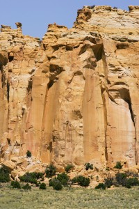
Horseshoe Bend, detail, in the San Rafael Swell north of I-70 west of exit 131.

Horseshoe Bend, detail, in the San Rafael Swell north of I-70 west of exit 131.

would like to come back to this place and spend more time exploring. Some of the rocks looked perfectly round, others looked like skinny walls. Do you remember making sand castles at the beach out of very wet sand? Letting the sand drip through your fingers. Some of the rocks looked like that. If you didn’t make those sand castles, cow manure drops in a similar fashion. All of the rocks, pinnacles and mountains were really, really red. I had only enough time to see one of the arches and a place called Windows. Rocks with giant holes. Unfortunately, there were again those people around. Luckily, not anywhere as bad as in Yellowstone.

Eagle Canyon - San Rafael Swell, I-70 exit 116.

Eagle Canyon – San Rafael Swell, I-70 exit 116.

Spent the night at the KOA in Moab. What a lousy night it was, couldn’t fall asleep and than woke up at 3 AM with the wind howling. The tent held up well, but when you are laying there and the wind is pressing against the walls of the tent you feel a little vulnerable. It was otherwise a beautiful night, the noon shone brightly, the stars were out in full force and it was warm, even at 3 AM.

Well, the next morning I was dead tired, coffee helped only moderately. I decided against seeing anymore of the sites in the area, would have been a waste on me. I headed for the Colorado border. After seeing so much amazing landscape, Colorado just couldn’t hold a candle to it or is it a light?

Arches National Park - Park Avenue

Arches National Park – Park Avenue

The mountains had moved closer to the road, no more wide open spaces. It is almost a blur to me, I was too tired and all I wanted was to get to a campsite and even more so, I want to get home! I remember a line of trees on top of a mountain ridge, looked kind of neat. The western part of Colorado was not anywhere as green and lush as I thought it would be. Still looked a little rugged. I had to drive over two major passes, one was around 7,000’ high and the other, Monarch Pass, measured over 11,000’. Coming down the first pass I looked down onto the Blue Mesa Reservoir, sunlight hitting the surrounding mountains, wow. No pullover possibility, no photo. The skies were gray and it rained from time to time. The drive along the Arkansas River was quite beautiful.

Arches National Park - Garden of Eden

Arches National Park – Garden of Eden

That night I was asleep at 9:30 PM. Unfortunately, I woke up with a nasty headache. I had no interest in seeing much of anything. I was in Cañon City, known for its Supermax prison…

After an amazingly good breakfast, veggie omelet with fresh! veggies I drove towards the Kansas border. I will be taking highway 50 all the way east.
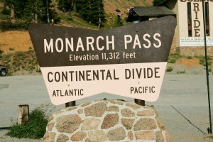
Monarch Pass, Continental Divide

Monarch Pass, Continental Divide

The landscape started to flatten out, no more mountains and that even before I got to Kansas.

The old St. Cloud Hotel, Main Street

The old St. Cloud Hotel – Cañon City

Highway 50 sign

Highway 50 sign – Kansas

This is a really small world. In Rocky Ford, Colorado I managed to get stuck in a ditch, nothing serious, but I knew I wouldn’t get out of it by myself. I walked to a farm stand around the corner and they pulled me out. We got talking and it turns out that a friend of the owner’s daughter went to New
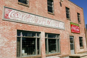
Old Coca Cola bottling building.

Old Coca Cola bottling building – Rocky Ford

York this summer to take ballet classes at the Joffrey Ballet School. She more than likely participated in the performance which I photographed. What are the odds?

Ingalls feed yard

Feed yard

Now I am in Dodge City, staying at the Holiday Motel. No camp grounds around. Not much happening in Kansas. Lots of feed yards around, not a pretty site and very smelly. This place is flat as a pancake.

Fields along highway 50

Fields along highway 50 – Kansas

Here are a few stats. miles driven: 10,000, nights in a motel: 11, nights with friends: 13, nights camped: 20, oil changes: getting ready for the third.

Sorry, that this is such a long e-mail. I just had to get it all down before I forget even more.

I’ll be home soon,

P.S. Leaving Lawrence Kansas in a minute, had to pay credit cards first, thanks to Starbucks & T-mobile.
Lake Tahoe to Ely

 August 30, 2007

What a day, rain, gray skies, creepiest place on earth, awesome sunlight, moonlight dinner. What else can anyone ask for? I could have done without the creepy place, more about that in a bit.

For now, I am going to skip my journey from Bellingham to San Francisco. It will follow, but I have to get today on paper before I forget all those different emotions I went through today.

I left Lake Tahoe mid morning heading east on highway 50, supposedly the loneliest highway in the US. The day started out gray, the light was flat

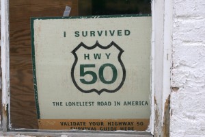
Highway 50 sign in General store

Highway 50 sign in General store

and it was just a question of time before it would rain. Carson City and the few towns to the east of it were sprinkled with casinos, we are in Nevada. Traffic was light and I didn’t have to scream at anyone J. Once I past Fallon the highway turned into a very lonely place, hardly any cars in either direction. And I thought hwy 26 in Oregon was empty. The mountains to the left and right of the highway were impressive. Some were more hills than mountains others had great peaks and the color changed constantly. Some were green covered with little bushes, others were rugged sandstone (?), red rock or even green rock. I don’t know if the green was the actual rock or if it came from the same plant that made the truck look like Kermit. I had cleaned the truck before I left Lake Tahoe and now it had this awful green grime all over it. The color of the sagebrush changed as well. Most if the time it looked dried out, gray green. In some places it was in full bloom with bright yellow blossoms, amazing contrasts. I would have taking pictures, but there was absolutely no light, just gray and flat. It was raining on and off, but the light could not break

Sand Mountain

Sand Mountain

through the clouds. I past through salt flats and wide open spaces only to be stopped by the distant mountains. Than there was this huge sand dune, called Sand Mountain. Looked completely out of place. I was a little frustrated that I could not get any good photos of this area. It was a beautiful place in the rain; I can’t even imagine what it must look like with a little sunlight.

I hadn’t past a town in a really long time, all the places on the map turned out to be tiny gatherings of trailers off the highway in the distance. The only larger place between Fallon and Ely, my destination, was Eureka. They even had an opera house. I am jumping ahead.

Eureka Opera House

Eureka Opera House

On the map I had seen a couple of ghost towns about 20 miles south of highway 50. I had never seen a real ghost town and thought it might be fun to check it out. I turned south on hwy 361, past the Middlegate Station, a weird salon & motel. This used to be the route for the Pony Express. There was nothing and nobody for miles, it was just me and the sagebrush. I misread a sign for the ghost town (Quartz Mountain), instead of turning left and continue for 5 miles, I went straight for another 5 miles. Couldn’t really see anything, according to the map it had to be off to the left. I did see a dirt road and some structure in the distance. I turned onto the dirt road and that’s when it started to get creepy. The road was bumpy and there was nothing but open space with sagebrush. The kind of place

Middlegate Station, highway 50 and route 361.

Middlegate Station, highway 50 and route 361.

where you expect someone to jump out from behind a bush with a rifle, like in the movies. So my mind is going a little overboard, I get this strange feeling and wished I wouldn’t be there. But I couldn’t turn around, not because the road was to narrow, but because I had to see what was at the end. I was pulled by an imaginary force. I did have a little reason to feel creepy. Early on there were the remains of an old car, couldn’t make out the model. As I went on I saw another one. This is the perfect place to lose something or someone. Nobody would ever find you for a million years. At the end of the road was an old mining shaft going straight into the ground, and some kind of wooden tower like structure. I had to get out of the truck to take pictures. Why am I doing this? There was not a sound to be heard, neither from humans nor from animals, just a little wind. There was a cross on the side of the road with “H & M” written on it and down the embankment was another old car, all rust, and it had bullet holes.

Cross and wrecked car at Quartz Mountain Ghost town.

Cross and wrecked car at Quartz Mountain Ghost town.

Your mind can go off in all sorts of strange directions from here. I guess the car served as target practice, I hope. Now that I was all creeped out I had to get back to the main road, which was 3 miles away. Neither of the cars looked like recent models, one of them had door handles like cars had back in the 50s and 60s. I so wanted to call someone just to hear a friendly voice, but I had no cell reception for the next 60 miles and than only for a short time. I was glad when I

The Shoe Tree. A cottonwood tree covered in shoes.

The Shoe Tree. A cottonwood tree covered in shoes.

was back on hwy 50. Ely was still hours away. The next “big” town was Austin. At least it had a gas station and even a library. There were only very few gas station along this stretch of highway. I was glad I had a full tank when I left Tahoe. Once on the other side of the mountains from Austin the sun made an appearance and not one minute too soon. It was sunset time and the light was incredible. The mountains got an intense red color and the green of bushes was a

wonderful contrast. I pulled over several times to take pictures. If I had done this all day long I would have gotten stuck in the desert over night, no thanks. Now it was time to hurry up and get to the campsite. I have gotten used to setting up tent in the dark, but I still don’t like to drive at night. Especially not when I am in an area without anyone around. The sun starts to set at around 7 PM, by 7:45 PM it is totally dark. It had started to sprinkle again when I arrived in Ely. I contemplated staying in a motel/hotel. There were several along the main drag. Many of them were casino/hotels. I stopped at one and walked in, the cigarette smell was not pleasant. I forgot, there are still places where smoking is permitted. I walked out and decided to camp. The rain had stopped. I pulled into a gas station to fill up and also to wash some of that grime off the truck before I put up the tent.
Highway 50 looking east from Pancake Summit, White Pine Nuts Mountains in the background.

Highway 50 looking east from Pancake Summit, White Pine Nuts Mountains in the background.

I safely arrived at the KOA three miles down the road. When I finished setting up tent, the moon had come up over the trees. It was very bright, on the decline, but still almost full. It was so bright that I didn’t need a flash light during dinner. What an incredible day! When was the last time you had dinner by moonlight?

I hope I can go to sleep now and not that my mind plays any tricks on me.

Good night.

P.S. I had no nightmares. Only woke up at 5AM because some stupid person was leaving the campsite with the car radio turned up loud.

Have a good Labor Day weekend. To all New Yorkers, this is your last chance to check out Coney Island with Astroland before it all gets torn down.

On the road again – going home

August 30, 2007

What a difference a day or two make.  After two beautiful days of rest at Lake Tahoe with my friends Lynn and Doug, I am off going east on highway 50.  My battery is recharged, my eyes are rested and I am ready for the home stretch.  I got tons of sleep (slept until 10 AM the first night) and I am ready to roll.

Lake Tahoe

Lake Tahoe


Details to follow soon, got to get going before it is noon again.

Tired

August 26, 2007

I don’t know where to start. As you might have noticed, my e-mails have become fewer and fewer. That’s not because I don’t want to write, but because my energy level has hit a low point. Also, I get to the campsite/motel too late to still pull out the computer and write. I am three weeks behind in my personal journal entries! Right now I just want to get home. It’s been almost five weeks on the road and in a different place almost every night. When I have stayed with friends, I have woken up and had no idea where I was. Sometimes I thought I was lying in the cab, not the bed, of the truck and I was surprised that the seats folded all the way back until I realized that I was sleeping in a very comfortable bed.

The beautiful scenery that I have been driving through for the last couple of days does not quite register the same way it did in the beginning, it’s just another tree.

Anyway, just a couple of additions to my last report:

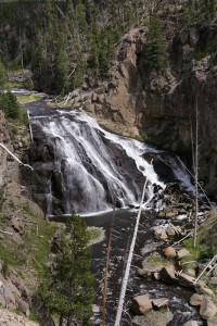
Yellowstone National Park - Gibbon Falls

Yellowstone National Park – Gibbon Falls

Yellowstone: the nights were freezing cold, only 43F/6C. I was very happy that my sleeping bag was rated up to 35F/3C and the only thing that got cold was my nose. It was not too pleasant to crawl out of the warm sleeping bag into the cold morning air and into the bathroom which only had cold running water. I know it was not as cold as my dad always tells us it was when he was a kid and he had to break the ice on his wash bowl in the morning.

Highway 26 looking west

Highway 26 looking west

Idaho: Even though I didn’t spent much time there the one thing that sticks to my mind is the very sweet smell of the wet wheat after a rain shower. You know the smell of fresh cut grass, multiple that by 10 and add a little more intensity and you get close to the smell of wet wheat, just wonderful.

In my last e-mail I promised to tell you about my trip from eastern Oregon to Bellingham. Bellingham is located about 60 miles south of the Canadian border along the coast of Washington State.

I started out in Ontario, OR driving west on route 26. This was probably the most isolated stretch of road I have traveled on so far. For miles and miles not a single car, never mind anything more than a farm or two. Just field after field and a lot of sagebrush. I turned onto a dirt road for about 12 miles and all I would see was some cattle and rolling hills as far as the eye could see. Unfortunately, I could also see the smoke from some wild fires. I drove thru a handful of almost

Old general store and phone booth

Old general store and phone booth

ghost towns. One of them was Unity, 50 miles away from any slightly larger town in any direction. Unity was never very large, used to be a logging town with 250+ people, now there are only 80 left and the mills closed down a couple of years ago. Throughout this trip I have seen many dilapidated buildings, abandoned years ago and left to rot. And sometimes it is not clear if someone is still living in the falling apart trailer home with the junk cars in front or not.

Old tiller off Willow Creek Road

Old tiller off Willow Creek Road

I was heading towards Sisters, a town named after the mountains just to the west of it. The peaks of those mountains were impressive. Unfortunately, I didn’t get to see much of them since the weather turned on me and clouds and rain rolled in. It was raining the next morning when I was leaving Sisters.

Due to the weather and a road closure I had to change my route to Bellingham. Instead of heading north from Sisters to Mt. Hood and than into Washington State passing Mt. St. Helens and Mt. Rainer before getting up to Bellingham, I drove west to Eugene. What a funky town. I haven’t seen so many grunch kids in a very long time, never mind so many homeless / drunk/drugged out people. Eugene is about two hours south of the Washington border and it is a pretty straight shot up on I-5 to Bellingham.

Figured I’ll be there by 8 PM, wrong it was 10 PM before I got there. It was the longest day up to then with the fewest stops and over 500 miles of driving. I am so glad that I had been avoiding the interstates.

I-5 is just awful. People don’t know how to drive; everyone drives in the left lane no matter what speed they go. It was so bad I was screaming at the drivers and eventually left the interstate and opted for a small detour with much better views, fewer drivers and no stress. I went back on I-5 north of Seattle; otherwise I would have never gotten to Bellingham.

I had two full days at my friend’s place which was great. I got to see the sites of the area and just had a nice relaxing time. However, the weather was not too kind to us, that is until I left, figures.

I spent this Sunday in San Francisco. Half the day with a friend, walking around the Castro and Mission areas which are quite beautiful with their very colorful vegetation and I am not talking about the people. The second half of the day I did something I hadn’t done on the entire trip. I did nothing! Didn’t want to go out, didn’t have to be anywhere, could just sit on the balcony and enjoy the little bit of sun that shines around here.

Tomorrow I am driving to Lake Tahoe where I’ll stay again with friends and in a couple of days I am heading home!

You have to wait until the next report to find out how I got from Bellingham down to SFO and how the moon showed me the way in the dark forests around Mt. St. Helens.

 Thanks for reading all my reports and for your feedback. I enjoy getting that as much as you seem to like my e-mails.

Good night and see you soon.

On The Road Again

August 22, 2007

After 2 full days of rest at my friend’s house in Bellingham, I am off again.  Heading towards the Oregon border via Mt. Rainier and Mt. St. Helens.  Skipping the Olympic Peninsula this time around, unfortunately.  Down the Oregon coast to SFO.

Barn off highway 26

Barn off highway 26

Not sure if I’ll make it by this weekend or not.
It feels like this trip is coming to an end, even though I still have 3 weeks left and a long drive home.

I’ll send more details about my drive from Ontario, OR to Bellingham soon.

Black Hills to Yellowstone

August 18, 2007

Where to start. It has been a long time since my last update and I have made it to Oregon, at least to Ontario on the south eastern border of the state.

Let’s go back 10 days.

Badlands National Park

Badlands National Park

I, as mentioned last time, I did not go to the Joan Jett concert, instead I stayed in the Badlands and tried to get some good photos with setting sunlight. Well, I didn’t get anything too exciting. Just couldn’t find a good spot, oh well. Would have been too tiered to drive 3 hours to Sturgis for the concert anyway. I didn’t

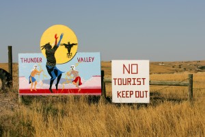
Lakota Indian reservation

Lakota Indian reservation

even make it to the Wounded Knee that day, next time.

Harley Davidson motorcycle rally - Main Street

Harley Davidson motorcycle rally – Main Street

The Black Hills. I don’t know why people are so excited about those hills. Is it because of Mount Rushmore and Custer State Park? I had no expectations and I was very disappointed. Drove along the Iron Mountain Drive thru the mini tunnels to see Mt. Rushmore and headed straight north out of the hills. Other than the pine smell, there was nothing much to write home about. It might not have helped a lot that there were gazillion bikers there either.

Mount Rushmore National Monument

Mount Rushmore National Monument

Bikers continued to crowd the roads all the way to Devil’s Tower in Wyoming. The bikers themselves are very nice folks. They just want to see the country as well. Some of them ride for 10 hours a day / 500 miles. I don’t even do that in the car. At the same time, they don’t really ride bikes; those Harleys are more like cushy chairs on wheels.

Devils Tower

Devils Tower

Devil’s Tower was pretty amazing. Not just a monolith in the middle of nowhere, but a monolith that is layered in a vertical way. It has something to do with the magma that was forced upward and when it cooled it contracted and fractured into columns. All this happened 60 million years ago. The drive from South Dakota to Devil’s Tower was suppose to take 1 ½ hours, it took me 3. I tend to drive very slowly in the beginning of the day to be able to see what’s around me and to be able to stop and take pictures. No, I don’t block traffic, I do pull over and let cars/bikes pass or there just is no traffic. I usually pay the price by the end of the day when I am nowhere near a campsite or motels. I made it to the campsite in Greybull, WY, about 3 hours east of Yellowstone. Thanks to the lack of sunlight, the sun was hiding behind clouds, I made it thru the Big Horn Mountains. If you ever make it out this way, you have to see these mountains they are stunning. The rock formations are amazing and the views are unbelievable.   There is supposed to be a waterfall, which I missed since I was rushing to make it to the campsite before nightfall. Setting up tent in the dark is not that much fun.

Horses by the Powder River Valley.

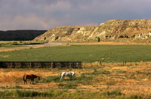
Horses by the Powder River Valley.

The next day I was wiped out. Couldn’t get going, had a nice conversation with the people running the campsite, they were from Amsterdam. Didn’t leave for Yellowstone until noon! It is just too much, not the driving, but too many impressions to adsorb. I feel like I have visited 3 museums a day for the last couple of weeks. I am not doing the landscape around me any justice. Good thing that I have stayed away from museums so far, I would be on total overload. I sat in the truck starring at the outskirts of Yellowstone Park before I drove in. Didn’t know if I could handle anymore.

Yellowstone; I am not sure what to think of it. Ask me in a couple of weeks. The drive into the park from Cody, the east entrance now closed because of the wildfire (17,000 acres burning), was great. Again, the

Yellowstone National Park - Dead trees at Mount Washburn

Yellowstone National Park – Dead trees at Mount Washburn

rock formations are unbelievable and the colors. Once I entered the park I was saddened by all the dead trees. In 1988 Yellowstone had several fires, all caused by lightning, in which case they are not fought, but they let them burn out. Yellowstone lost 36% of its trees and they have not yet grown back. It is almost depressing to see so many bare trees standing there like matches just waiting to fall.

Geologically, Yellowstone is very interesting and I think there is even some wildlife.

The biggest wildlife comes on two legs and it is called humans. I haven’t seen this many people since I left New York. This makes me wonder how I will handle the masses of people when I get back. It seems that people checked their common sense at the entrance of the park. They see bison, of which there are a lot in Yellowstone, they stop and walk up to them to have their picture taken. They stop in the middle of the

Yellowstone National Park - "Artist Paint Pot"

Yellowstone National Park – “Artist Paint Pot”

road, walk across the road where they shouldn’t, pull into parking spots for which you already signaled (feels like NYC). They should really limit the number of people they let into the park at one time. I guess, summer is not the best time to come and visit. I spent 3 nights in Yellowstone. I did see a grizzly, but even thru my 300mm lens he was just a small dot. Saw Old Faithful go off and even better, saw the Beehive Geyser go off which only happens a few times a week. Did take a “bath” in the Boiling River, needed it after a 3 hour hike up and down Mt. Washburn. The highest spot in Yellowstone, 10,400 feet or so with a 1,400’ incline. At the end of the third day I was so tired of seeing people that I asked the ranger at the campsite check-in where I could go for some peace and quiet. She suggested a pebble beach along

Yellowstone National Park - Old Faithful geyser

Yellowstone National Park – Old Faithful geyser

Yellowstone Lake, near a boat landing. What bliss. Only a few people and some kayaks. I was in luck; I joined a small group of kayakers for a 2 hour tour on the lake. Not as relaxing as laying on the beach, but what an opportunity to see Yellowstone from the water. Paddled along some geysers and even saw an elk standing at water’s edge. I moved very slowly not to entice her to swim out to the kayak. Since I wanted to be back on land before sunset, I had to paddle a little faster than the rest of the group on the way back. What a work out, had a sore butt the next day.

Yellowstone National Park - Dawn over Yellowstone Lake

Yellowstone National Park – Dawn over Yellowstone Lake

Left for Grand Teton the next morning. Now those are real mountains. Had to control myself not to take too many pictures of the same mountain. There were fewer people in the Grand Teton compared to Yellowstone, but still too many. Went for a little walk, this time just flat no major inclines. Stuck my feet into Jenny Lake and headed for Jackson.

I stayed for two nights with friends in Jackson. They took me in with open arms. They are filmmakers / photographers and we had plenty of shop talk. They live outside of Jackson in a very quiet area surrounded by buttes. The hummingbirds were buzzing around our heads, I am not kidding. They have a feeder on the patio and those little birds dart for it often missing your head only by inches. The buzzing of

Teton Range and Jackson Lake in the Grand Teton National Park. Far left Grand Teton Mountain on right Mt. Moran.

Teton Range and Jackson Lake in the Grand Teton National Park. Far left Grand Teton Mountain on right Mt. Moran.

their wings is tremendous. Even saw a bald eagle pair and a juvenile eagle sitting in the trees across the Snake River from their patio. Who needs Yellowstone. Went to a local rodeo, was fun to watch it in person. I was very happy to have some company for a while and sleeping in a real bed with a private bathroom was not bad either. Since Richard and Diane had traveled the US extensively, they could give me some good travel tips. I changed my route slightly. Instead of going north thru Idaho to Washington State, I am only driving thru the southern part of Idaho and than into Oregon to a place called Sisters. From there I’ll head north to Mt. Hood and into Washington State, Mt. St. Helens and maybe Mt. Rainier. Since I am heading all the way up north to Bellingham to stay with a friend for a couple of days, I might save Mt. Rainier for the way back down. Looking at the calendar, time seems to be running away.

Farmland along highway 20/26

Farmland along highway 20/26

From Jackson I only made it to Twin Falls in Idaho. Saw several wildfires in the distance. Driving thru Arco, the air ways filled with smoke. There are fires burning all over Montana and the eastern side of Idaho.

I got eaten alive by mosquitoes at the Twin Falls campsite. Still itches like crazy. Twin Falls has a beautiful waterfall, 50’ higher than Niagara Falls and not commercialized and hardly any people!!!

Shoshone Falls

Shoshone Falls

I have to get some breakfast now, it is already 8:30 AM. Have been typing for the last hour or so.

Train tracks at sunset

Train tracks at sunset

Have a nice weekend.

I start to forget what day of the week it is.

Dakotas

August 8, 2007

It’s turning into an adventure. First of, North Dakota is not flat and if anyone tells you that there is nothing to see, they are dead wrong. Where as the east was pretty and green with all its lakes, North Dakota is rugged and awesome. You would not believe the multitude of colors. I don’t remember having seen such a variety of greens, dark, light, silvery looking green.

Straw bales

Straw bales

Don’t get me started on the yellow, orange and gold of the wheat fields and the yellow of the sunflower

Sunflower field along highway 85 north of Bowman.

Sunflower field along highway 85 north of Bowman.

fields. All these colors intensify with the afternoon sunlight or during/after a thundershower. Can’t tell you how many “ohmygod” moments I had. The spaces are wide open, but not flat. The fields are more like rolling hills.

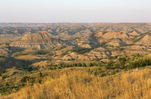
Driving from Fargo 350 miles straight west you get to the North Dakota Badlands. All of a sudden, the fields disappear and the landscape changes into all these free standing peaks. Think of it as if water washed through land, cutting hundreds of riverbeds into the ground and all that’s left standing are these peaks. This particular area is called Painted Canyon. Some of the tips of the peaks are red and I arrived just in time for sunset!

Theodore Roosevelt National Park - Painted Canyon

Theodore Roosevelt National Park – Painted Canyon

I set up camp just outside the Badlands park, pretty neat.

I almost was adopted by a cat. She came around while I was packing up, jumping up on the cabin of the truck watching. But she decided to go back to her family.

I saw my first prairie dogs, they are very cute, not much larger than a NYC subway rat, but much more adorable. I thought that was exciting. Not more than five minutes later a bison crosses the road, how cool is that? Just around the corner from that was a whole herd of about 100 bison, wow. They were just outside the parks campground. I had intended to stay there the night before. I am glad I didn’t; don’t know how I would have taken it if a bison would have knocked on my door. Spent almost an hour

Badlands National Park - Prairie dog

Badlands National Park – Prairie dog

watching these amazing animals. Sometimes one of the bulls would charge after another bull and parts of the herd would move across the road, where the cars were lined up watching. The bison were literally at arms length. Nothing could top this experience. After lunch I headed south to the South Dakota Badlands and Sturgis. The Harley rally is in full swing.

The drive was beautiful, more amazing colors. The great thing is that there is no traffic in North Dakota and the road I was traveling on was very, very empty, which made pulling over to take pictures that much easier.

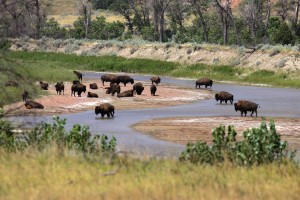
Theodore Roosevelt National Park - Badlands, South Unit - Bison at Little Missouri River

Theodore Roosevelt National Park – Badlands, South Unit – Bison at Little Missouri River


There are hardly any towns along the way. They post the towns’ name, but don’t even bother with a population count; there might just be a dozen homes along the road. When the settlements get a little larger, they do post population counts. The lowest I have seen was in the low hundreds.

South Dakota’s landscape changes only slightly. The fields change into rugged grassing land. It was very hot all day long, mid 90s. It didn’t feel that bad with the wind. The wind was so strong that it blew me off the truck when I was standing on the rear bumper. Holding the camera still was another challenge.

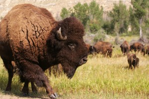
Theodore Roosevelt National Park - Badlands, South Unit - Bison

Theodore Roosevelt National Park – Badlands, South Unit – Bison

Getting closer to Sturgis the number of bikers increased. They had been passing me in both directions all day long. These are crazy people. Most of them wear no helmets whatsoever and shirts are optional.

Driving towards Sturgis the mountains start to rise.

The Black Bear Butte is the most prominent peak. Sturgis is full with bikes and bikers. The streets are filled with the roar of their engines, cool.

Bikers at the entrance to I-90, exit 78

Bikers at the entrance to I-90, exit 78

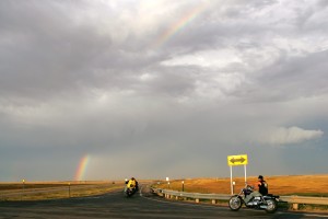
I wanted to spend the night in the Badlands, just 1 ½ hours further south east. Make that 2 hours with stopping. I drove this last stretch on the interstate, usually an uneventful drive. Except there was this big rainbow in the sky. Behind me the sky was clear and beautiful; ahead of me it started to get dark quickly.

I had to pull off the interstate to just get the right picture. It had started to rain a little and the road was wet, that combined with the setting sunlight made for one heck of a photo. Driving on I could see the sun setting in my rearview mirrors. Sometimes the best pictures are behind you.

Old Highway 14-16 looking east intersecting with 173rd Avenue.  Wicksville Community Church on left.

Old Highway 14-16 looking east intersecting with 173rd Avenue. Wicksville Community Church on left.

That’s were the fun ended. I called the KOA campsite to make sure that they still have space and that they would be still open when I got there. Yes to both questions. However, I was cutting it close. The site was 30 minutes from the interstate. The rain had turned into a thunderstorm with lighting and somehow I didn’t feel like spending the night in a tent, call me chicken if you want. There were a couple of motels along the way to the campsite, but they were all sold out. It had stopped raining, but now it was just dark. Setting up tent in the dark was not my idea of fun. That’s when I came across the “Bates” motel. Funky old people running the place. They too were full, but they offered me a trailer which didn’t have hot water, but all other amenities functioned. This little old totally wrinkly woman showed me the trailer. The smell was not pleasant, as it turns out there were several leaks in the trailer, one of them above the bed. Thank God for the pull out couch. I had two choices, move on set up tent in the dark and get rained on or live with the smell and the springs of the mattress in my back. I opted for later one. I had my camping mattress and all would be fine. That is if I had my mattress. As it turns out I had left it at the last campsite. I had put it on the picnic bench when I was loading the truck and forgot it. The mattress goes in last since I don’t deflate it while traveling. Shit. What a lousy ending to a great day. A call to the campsite didn’t turn up anything. They will look again in the morning; they too had very strong winds. I would drive back if it wouldn’t be over 300 miles. I’ll keep you posted. I might find a place around here which sells those things or I have to order it from NJ and have them FedEx it. It is 7:30 am, I have to get going the sunlight is still nice.

More adventures to come.


P.S. I found a new mattress at Wall Drug. Works just fine.