Category Archives: Idaho

Tired

August 26, 2007

I don’t know where to start. As you might have noticed, my e-mails have become fewer and fewer. That’s not because I don’t want to write, but because my energy level has hit a low point. Also, I get to the campsite/motel too late to still pull out the computer and write. I am three weeks behind in my personal journal entries! Right now I just want to get home. It’s been almost five weeks on the road and in a different place almost every night. When I have stayed with friends, I have woken up and had no idea where I was. Sometimes I thought I was lying in the cab, not the bed, of the truck and I was surprised that the seats folded all the way back until I realized that I was sleeping in a very comfortable bed.

The beautiful scenery that I have been driving through for the last couple of days does not quite register the same way it did in the beginning, it’s just another tree.

Anyway, just a couple of additions to my last report:
Yellowstone National Park - Gibbon Falls

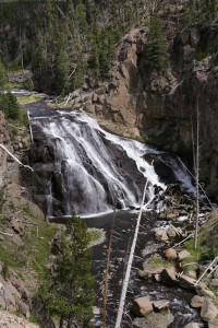
Yellowstone National Park – Gibbon Falls

Yellowstone: the nights were freezing cold, only 43F/6C. I was very happy that my sleeping bag was rated up to 35F/3C and the only thing that got cold was my nose. It was not too pleasant to crawl out of the warm sleeping bag into the cold morning air and into the bathroom which only had cold running water. I know it was not as cold as my dad always tells us it was when he was a kid and he had to break the ice on his wash bowl in the morning.

Highway 26 looking west

Highway 26 looking west

Idaho: Even though I didn’t spent much time there the one thing that sticks to my mind is the very sweet smell of the wet wheat after a rain shower. You know the smell of fresh cut grass, multiple that by 10 and add a little more intensity and you get close to the smell of wet wheat, just wonderful.

In my last e-mail I promised to tell you about my trip from eastern Oregon to Bellingham. Bellingham is located about 60 miles south of the Canadian border along the coast of Washington State.

I started out in Ontario, OR driving west on route 26. This was probably the most isolated stretch of road I have traveled on so far. For miles and miles not a single car, never mind anything more than a farm or two. Just field after field and a lot of sagebrush. I turned onto a dirt road for about 12 miles and all I would see was some cattle and rolling hills as far as the eye could see. Unfortunately, I could also see the smoke from some wild fires. I drove thru a handful of almost

Old general store and phone booth

Old general store and phone booth

ghost towns. One of them was Unity, 50 miles away from any slightly larger town in any direction. Unity was never very large, used to be a logging town with 250+ people, now there are only 80 left and the mills closed down a couple of years ago. Throughout this trip I have seen many dilapidated buildings, abandoned years ago and left to rot. And sometimes it is not clear if someone is still living in the falling apart trailer home with the junk cars in front or not.

Old tiller off Willow Creek Road

Old tiller off Willow Creek Road

I was heading towards Sisters, a town named after the mountains just to the west of it. The peaks of those mountains were impressive. Unfortunately, I didn’t get to see much of them since the weather turned on me and clouds and rain rolled in. It was raining the next morning when I was leaving Sisters.

Due to the weather and a road closure I had to change my route to Bellingham. Instead of heading north from Sisters to Mt. Hood and than into Washington State passing Mt. St. Helens and Mt. Rainer before getting up to Bellingham, I drove west to Eugene. What a funky town. I haven’t seen so many grunch kids in a very long time, never mind so many homeless / drunk/drugged out people. Eugene is about two hours south of the Washington border and it is a pretty straight shot up on I-5 to Bellingham.

Figured I’ll be there by 8 PM, wrong it was 10 PM before I got there. It was the longest day up to then with the fewest stops and over 500 miles of driving. I am so glad that I had been avoiding the interstates.

I-5 is just awful. People don’t know how to drive; everyone drives in the left lane no matter what speed they go. It was so bad I was screaming at the drivers and eventually left the interstate and opted for a small detour with much better views, fewer drivers and no stress. I went back on I-5 north of Seattle; otherwise I would have never gotten to Bellingham.

I had two full days at my friend’s place which was great. I got to see the sites of the area and just had a nice relaxing time. However, the weather was not too kind to us, that is until I left, figures.

I spent this Sunday in San Francisco. Half the day with a friend, walking around the Castro and Mission areas which are quite beautiful with their very colorful vegetation and I am not talking about the people. The second half of the day I did something I hadn’t done on the entire trip. I did nothing! Didn’t want to go out, didn’t have to be anywhere, could just sit on the balcony and enjoy the little bit of sun that shines around here.

Tomorrow I am driving to Lake Tahoe where I’ll stay again with friends and in a couple of days I am heading home!

You have to wait until the next report to find out how I got from Bellingham down to SFO and how the moon showed me the way in the dark forests around Mt. St. Helens.

 Thanks for reading all my reports and for your feedback. I enjoy getting that as much as you seem to like my e-mails.

Good night and see you soon.

Black Hills to Yellowstone

August 18, 2007

Where to start. It has been a long time since my last update and I have made it to Oregon, at least to Ontario on the south eastern border of the state.

Let’s go back 10 days.

Badlands National Park

Badlands National Park

I, as mentioned last time, I did not go to the Joan Jett concert, instead I stayed in the Badlands and tried to get some good photos with setting sunlight. Well, I didn’t get anything too exciting. Just couldn’t find a good spot, oh well. Would have been too tiered to drive 3 hours to Sturgis for the concert anyway. I didn’t

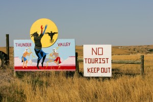
Lakota Indian reservation

Lakota Indian reservation

even make it to the Wounded Knee that day, next time.

Harley Davidson motorcycle rally - Main Street

Harley Davidson motorcycle rally – Main Street

The Black Hills. I don’t know why people are so excited about those hills. Is it because of Mount Rushmore and Custer State Park? I had no expectations and I was very disappointed. Drove along the Iron Mountain Drive thru the mini tunnels to see Mt. Rushmore and headed straight north out of the hills. Other than the pine smell, there was nothing much to write home about. It might not have helped a lot that there were gazillion bikers there either.

Mount Rushmore National Monument

Mount Rushmore National Monument

Bikers continued to crowd the roads all the way to Devil’s Tower in Wyoming. The bikers themselves are very nice folks. They just want to see the country as well. Some of them ride for 10 hours a day / 500 miles. I don’t even do that in the car. At the same time, they don’t really ride bikes; those Harleys are more like cushy chairs on wheels.

Devils Tower

Devils Tower

Devil’s Tower was pretty amazing. Not just a monolith in the middle of nowhere, but a monolith that is layered in a vertical way. It has something to do with the magma that was forced upward and when it cooled it contracted and fractured into columns. All this happened 60 million years ago. The drive from South Dakota to Devil’s Tower was suppose to take 1 ½ hours, it took me 3. I tend to drive very slowly in the beginning of the day to be able to see what’s around me and to be able to stop and take pictures. No, I don’t block traffic, I do pull over and let cars/bikes pass or there just is no traffic. I usually pay the price by the end of the day when I am nowhere near a campsite or motels. I made it to the campsite in Greybull, WY, about 3 hours east of Yellowstone. Thanks to the lack of sunlight, the sun was hiding behind clouds, I made it thru the Big Horn Mountains. If you ever make it out this way, you have to see these mountains they are stunning. The rock formations are amazing and the views are unbelievable.   There is supposed to be a waterfall, which I missed since I was rushing to make it to the campsite before nightfall. Setting up tent in the dark is not that much fun.

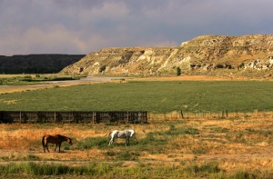
Horses by the Powder River Valley.

Horses by the Powder River Valley.

The next day I was wiped out. Couldn’t get going, had a nice conversation with the people running the campsite, they were from Amsterdam. Didn’t leave for Yellowstone until noon! It is just too much, not the driving, but too many impressions to adsorb. I feel like I have visited 3 museums a day for the last couple of weeks. I am not doing the landscape around me any justice. Good thing that I have stayed away from museums so far, I would be on total overload. I sat in the truck starring at the outskirts of Yellowstone Park before I drove in. Didn’t know if I could handle anymore.

Yellowstone; I am not sure what to think of it. Ask me in a couple of weeks. The drive into the park from Cody, the east entrance now closed because of the wildfire (17,000 acres burning), was great. Again, the

Yellowstone National Park - Dead trees at Mount Washburn

Yellowstone National Park – Dead trees at Mount Washburn

rock formations are unbelievable and the colors. Once I entered the park I was saddened by all the dead trees. In 1988 Yellowstone had several fires, all caused by lightning, in which case they are not fought, but they let them burn out. Yellowstone lost 36% of its trees and they have not yet grown back. It is almost depressing to see so many bare trees standing there like matches just waiting to fall.

Geologically, Yellowstone is very interesting and I think there is even some wildlife.

The biggest wildlife comes on two legs and it is called humans. I haven’t seen this many people since I left New York. This makes me wonder how I will handle the masses of people when I get back. It seems that people checked their common sense at the entrance of the park. They see bison, of which there are a lot in Yellowstone, they stop and walk up to them to have their picture taken. They stop in the middle of the

Yellowstone National Park - "Artist Paint Pot"

Yellowstone National Park – “Artist Paint Pot”

road, walk across the road where they shouldn’t, pull into parking spots for which you already signaled (feels like NYC). They should really limit the number of people they let into the park at one time. I guess, summer is not the best time to come and visit. I spent 3 nights in Yellowstone. I did see a grizzly, but even thru my 300mm lens he was just a small dot. Saw Old Faithful go off and even better, saw the Beehive Geyser go off which only happens a few times a week. Did take a “bath” in the Boiling River, needed it after a 3 hour hike up and down Mt. Washburn. The highest spot in Yellowstone, 10,400 feet or so with a 1,400’ incline. At the end of the third day I was so tired of seeing people that I asked the ranger at the campsite check-in where I could go for some peace and quiet. She suggested a pebble beach along

Yellowstone National Park - Old Faithful geyser

Yellowstone National Park – Old Faithful geyser

Yellowstone Lake, near a boat landing. What bliss. Only a few people and some kayaks. I was in luck; I joined a small group of kayakers for a 2 hour tour on the lake. Not as relaxing as laying on the beach, but what an opportunity to see Yellowstone from the water. Paddled along some geysers and even saw an elk standing at water’s edge. I moved very slowly not to entice her to swim out to the kayak. Since I wanted to be back on land before sunset, I had to paddle a little faster than the rest of the group on the way back. What a work out, had a sore butt the next day.

Yellowstone National Park - Dawn over Yellowstone Lake

Yellowstone National Park – Dawn over Yellowstone Lake

Left for Grand Teton the next morning. Now those are real mountains. Had to control myself not to take too many pictures of the same mountain. There were fewer people in the Grand Teton compared to Yellowstone, but still too many. Went for a little walk, this time just flat no major inclines. Stuck my feet into Jenny Lake and headed for Jackson.

I stayed for two nights with friends in Jackson. They took me in with open arms. They are filmmakers / photographers and we had plenty of shop talk. They live outside of Jackson in a very quiet area surrounded by buttes. The hummingbirds were buzzing around our heads, I am not kidding. They have a feeder on the patio and those little birds dart for it often missing your head only by inches. The buzzing of

Teton Range and Jackson Lake in the Grand Teton National Park. Far left Grand Teton Mountain on right Mt. Moran.

Teton Range and Jackson Lake in the Grand Teton National Park. Far left Grand Teton Mountain on right Mt. Moran.

their wings is tremendous. Even saw a bald eagle pair and a juvenile eagle sitting in the trees across the Snake River from their patio. Who needs Yellowstone. Went to a local rodeo, was fun to watch it in person. I was very happy to have some company for a while and sleeping in a real bed with a private bathroom was not bad either. Since Richard and Diane had traveled the US extensively, they could give me some good travel tips. I changed my route slightly. Instead of going north thru Idaho to Washington State, I am only driving thru the southern part of Idaho and than into Oregon to a place called Sisters. From there I’ll head north to Mt. Hood and into Washington State, Mt. St. Helens and maybe Mt. Rainier. Since I am heading all the way up north to Bellingham to stay with a friend for a couple of days, I might save Mt. Rainier for the way back down. Looking at the calendar, time seems to be running away.

Farmland along highway 20/26

Farmland along highway 20/26

From Jackson I only made it to Twin Falls in Idaho. Saw several wildfires in the distance. Driving thru Arco, the air ways filled with smoke. There are fires burning all over Montana and the eastern side of Idaho.

I got eaten alive by mosquitoes at the Twin Falls campsite. Still itches like crazy. Twin Falls has a beautiful waterfall, 50’ higher than Niagara Falls and not commercialized and hardly any people!!!

Shoshone Falls

Shoshone Falls

I have to get some breakfast now, it is already 8:30 AM. Have been typing for the last hour or so.

Train tracks at sunset

Train tracks at sunset

Have a nice weekend.

I start to forget what day of the week it is.

Idaho – not just potatoes

OK, just want to go back to chronological order.
I left Spokane heading north on a small, narrow, curvy road that runs parallel to hwy 2. Sometimes, I ask myself why I choose these roads and I quickly remember when I am back on major roads with all the traffic and no place to stop. When I drove to Spokane I was surrounded by wheat fields and desert and now I was once again surrounded by pine trees and some birch trees that showed already their fall colors and it was only early September.
Originally, I thought I would drive through Coeur d’Alene and then go up north; however, I had no interest to go back on I-90 with crazy drivers. So I opted for highway 2.

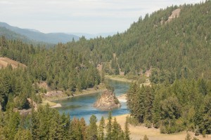
Kootenai River my campground- idyllic

Highway 2 leads through the narrow panhandle of Idaho with lot’s of pine and mixed tree forests. A stark contrast to southern Idaho with its lava fields and a much more barren landscape. Before I knew it I had almost driven through Idaho with only one little stop in Bonners Ferry for lunch. No, no, I can’t just drive through this beautiful place and not haven taken a single photo. So, instead of continuing into Montana, I stopped in Moyie Springs, twelve miles west of the Montana border, and stayed at the Twin Rivers campground. The campground was down in a valley at the confluence of the the Kootenai River and Moyie River. The road down to the campground was pretty steep and of course a dirt road. The drive down was definitely worth it. My site was surrounded by pine trees and the river was just 50 yards away. What a difference to the asphalt lot I stayed in the night before. I spent the afternoon walking along the river, just enjoying the peace and quiet, skipping rocks. OK, nothing is ever perfect. At the top of the mountain was a lumber mill with the equipment running 24/7. The noise was not very loud, but annoying enough when I tried to fall asleep.

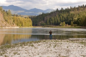
Kootenai River

I managed to leave early the next morning, but was robbed by one hour as soon as I crossed into Montana. I do prefer heading west where you gain an hour. The scenery just got better. I don’t know if you ever watched the 1992 movie “A River Runs Through It” directed by Robert Redford with Brad Pitt. If you haven’t, google it and watch the fly fishing scene, then you know what I looked at throughout my drive thru eastern Montana. There are many wide mountain rivers and I couldn’t help but to constantly think of that fly fishing scene, gorgeous.

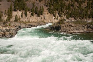
Kootenai Falls

The drive to Glacier National Park lead through forests and mountains with rivers running along side the road. The mountains ran parallel to the road until I arrived in Kalispell and I all of a sudden faced this huge mountain range right in front of me. The Rocky Mountains. Wow, what a site. These are truly impressive mountains. Fortunately, I didn’t have to drive over them at this time.

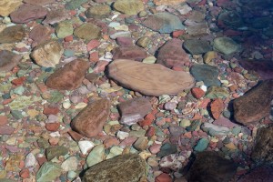
Crystal clear water at Lake McDonald

At Glacier I camped at the Apgar campground right in woods by Lake McDonald. No electricity or running water. That solar panel on the top of my camper came in very handy, kept my batteries charged for the four days I stayed in Glacier.

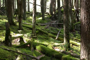
Glacier - Moss covered hemlocks

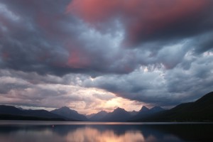
Glacier is quite incredible. I have never seen clear water like that in Lake McDonald and the rivers around it. Mountain reflections in the lake look like paintings.

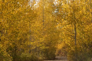
Fall colors - Aspen trees

One of my excursions led to Bowman Lake, north west of Lake McDonald. It was supposed to be this very quiet spot not too many people travel to. Well, there were not too many people, but it wasn’t quiet. Unfortunately, sound traveled extremely well at the lake and I could follow people’s conversations from several hundred feet away. So much for a quiet place. There are two roads that lead to Bowman Lake, the Inside North Fork Road, 30 miles of not so fun dirt road. Took me over three hours to get to the lake. The other route is on Camas Road and the Outside North Fork Road. A mix of asphalt and dirt road, but not anywhere as bad as the inside road. Took just over one hour to get back.

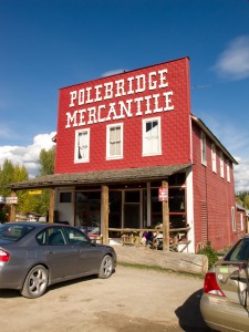
Polebridge Mercantile

Treat yourself to some great baked goods at the Polebridge Mercantile just before Bowman Lake. The huckleberry bear claw was wonderful. I wish I had taken the Outside road in both directions.

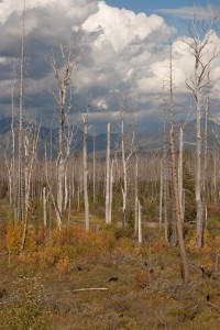
Glacier - Dead trees

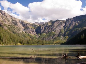
The other excursion was a four mile round trip hike to Avalanche Lake. I usually don’t go on these slightly longer hikes, but I was told I definitely should, so I did. It was a mostly uphill hike. Avalanche Lake is completely surrounded by mountains.

Avalanche Lake

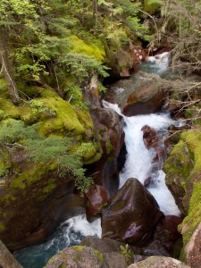
Avalanche Gorge

On the eastern side, several waterfalls run down the mountains, very cool. Despite the fact that there were a bunch of people, it was peaceful. I stayed for a while just marveling at the sites. I don’t know what possessed me, but I had to run back. It was downhill and who can resist running downhill? I wasn’t dressed for a run, but I have to say I made pretty good time, 25 minutes for two miles over roots and rocks is not too shabby. I slept well that night.

Lake McDonald at sunset