You would have never thought that you are still in Washington State once you were south of Nespelem on highway 155. Last night I stayed at Pearrygin Lake State Park. Since it was overcast when I arrived, I could not see the real beauty of the surrounding area.
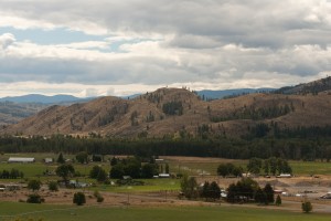
Methow Valley
Rolling hills sprinkled with trees. Not quite the same golden hills I have come to love in California. These didn’t have the golden grass, they had more of a brown tint to them. Driving east on highway 20 the hills stayed with me until I hit highway 155 when they just disappeared. It was not after I had made it through the mountains and forests of the Colville Indian Reservation when they resurfaced. However, this time they looked more like the off-spring of a California / Oregon marriage. The trees were replaced by sagebrush; the hills were no longer just round toped rolling hills, but more of the jagged edge variety. Add to that a handful of lava rocks; voila you have arrived in Eastern Washington.
The natural beauty of the area was disturbed by the massive Coulee Dam; the largest concrete structure in the United States. I guess that’s something to be proud of. The dam produces more electricity than any other.
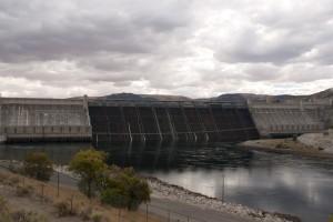
Grand Coulee Dam
Once I got past this behemoth, nature took over again. I only continued for a little longer on highway 155 along the Banks Lake. Now the rocks had changed even more and looked more like New Mexico mountains covered in light green moss.
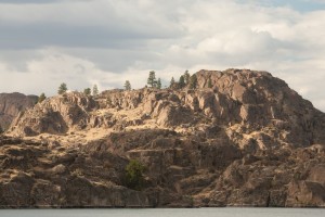
Banks Lake
The diversity of this country never stops to amaze me. Here in Washington you have a rain forest in the far west, moss covered trees just a little further east, the great Pacific with the San Juan Islands, which I still have to visit, and desert like conditions in the east. Can it get any better?
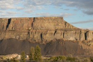
Cliff along Banks Lake
I spent the night at the Steamboat Rock State Park, just across from the highway, but it was really quiet. I had a gorgeous view onto this incredible rock on one side and the Banks Lake on the other. The lake is framed on two sides by great cliffs, straight up several hundred feet. You drive right next to one of them and realize how small you are and how insignificant you seem in the greater picture of nature. These cliffs have been here long before us and they are bound to be here long after we are gone.
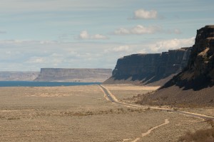
Banks Lake
Before heading east I made a little detour to see the Dry Falls; once the most powerful waterfall on the planet. We go a few years back to the last ice age when the Columbia River ran over the falls. Wow, I can’t even image what it must have been like. It measured about 400 feet in height (that’s twice as tall as Niagara Falls) and over three miles in length. One could have produced quite a bit of energy with that one.
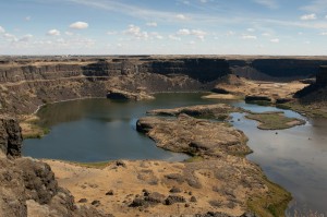
Incredible Dry Falls
Things come and go very quickly around here. Trees, cliffs it doesn’t matter. The cliffs of the Banks Lake just faded away and were replaced by farmland. I was surrounded by plowed fields, harvested and un-harvested wheat fields as I drove east on highway 2. The fields were gently rolling, like sand dunes.
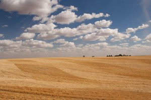
Wheat filed
The afternoon light hitting the yellow stalks just right to look like gold. These fields are actually planted in an area considered desert.
By early afternoon I started to get tired really fast. I had hoped to make it to Idaho, but it looked like it would only be Spokane, Washington. Campgrounds near a large city are usually not the most beautiful and nature oriented once. The campground / RV Resort I ended up in was no exception. If you like asphalt and road noise this place was for you. It was a parking lot. OK, there were some shrubs and trees between sites, but it was not enough to give you much privacy. On top of it, I was facing the wall of a storage building, lovely. After so much beauty, how on earth did I end up at this RV park? A near by state park was full and another park further away did not return my call to let me know if they had space until I was already checked in, too bad. Good thing it was only for one night.
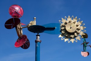
Road side curiosity - Gehrke windmill
